New Photos
January 27, 2007
| Water, water everywhere...and plenty for wildlife to drink | |
 |
|
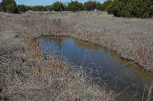
| Just below the dry woods, there's a dip--probably created when the land was terraced decades ago. At any rate, it fills from below, through seeps off the impervious rock under the dry woods, and produces some of the clearest, prettiest water on the place. But since it's high and dry most of the time, any plant living here must tolerate periodic wet feet and also periodic long dry spells. | |
 |
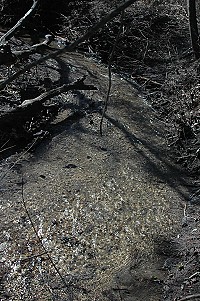 |
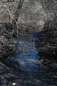
| Here the creek is down from a flash flood, and the water is clearing but still somewhat turbid. It's been a long time since we had water flowing this clear in the creek, and that means the springs upstream are running. | At the south end, from the plank bridge to the fence, the creek has already cleared up some and makes little riffles over gravel. |
 |
|
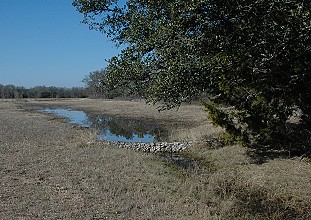
| The main flood-overflow channel is east of the creek proper, just insde the creek woods. At its outlet, it forms a crescent shaped pool, probably two feet or a little more in depth , that we call the swamp--but except in a flood itself, it's spring-fed in high-water periods. | |
 |
|
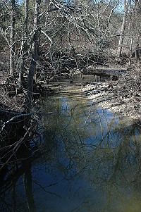
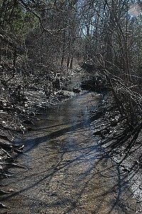
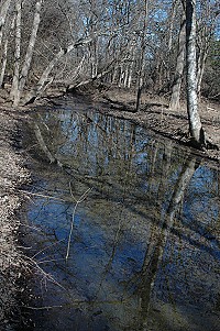
| Upstream and around a corner from the south trail crossing, Westbrook shows what a fairly healthy tiny woodland stream should look like. If it had constant flow, it would have appropriate aquatic and streamside vegetation as well, but it does have abundant woody vegetatation on both sides and no channelizing or other artificial shaping has been done. It has curves, with the main current shifting from side to side, with riffles and deeper areas. It offers perfect places for wildlife to drink. | |
 |
 |
| On the west end, between the NW and SW meadows, the woods surrounding Westbook are very narrow, but still sufficient to provide cover and habitat. The gravel crossing we put in to get vehicles into the SW meadow has slowed the release of water--preventing damaging scour from floodwater coming off the fields to our west. Here this water has temporarily risen out of the channel and makes a quiet pool upstream. | Coming out of the gravel, the water is much clearer and makes a lovely sound as it gurgles cheerfully toward the turns that will take it to the south fenceline |
 |
 |
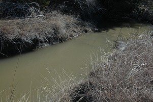
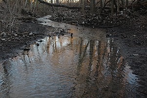
| The creek's other flood overflow system starts near the north end of our property, and diverts water into a gully system that runs semi-parallel to the creek but west of it. As this system turns back to meet the creek, it sometimes overtops its banks and dumps water into this--the last diversion channel. Water here is usually turbid, and stays turbid longer than anywhere else, because there is no spring or seep feeding it clear water. The sides below the grass are bare and almost vertical; at the downstream end, the pale soil gouged out above has formed weak dams. | When we first bought the place, the gully system was suffering active erosion and looked terrible. When it had water in it, it was a wildlife resource (neighbor kids told us they'd once seen Canada geese on it) but otherwise it was a disaster. It still isn't the prettiest of sights when dry, but when we get rain and the active flooding is done, this is what it looks like--a series of healthy prairie swales like this. It gets runoff from neighbors' fields as well as flood pulses from the creek, so there will always be some erosion--but less, as more native grasses that can handle flood-and-drought colonize the area. |
 |
|
| Coming back on the south trail in the evening, reflections in the shallow water of Westbrook near the south fenceline. There's an "island" just upstream which has split the water, and here it's coming back together. | |
 |
|
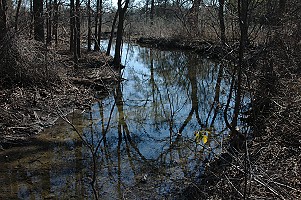
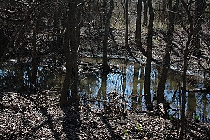
| Above the lower swamp-stream there's another large crescent shaped pool or slow stream that we call the "middle swamp." It is not as deep as the lower swamp (which is too deep to wade through unless you want your boots full of water) but it's at least as wide. | |
![]()